
TerraLens
Fly the Earth with your hands and your voice.
TerraLens is a 3D geographic instrument you operate by hand gesture, by voice or by keyboard. Bring any dataset you own and it becomes a layer, with its source and licence printed beside every number.
See it on your own dataDownload the brochure PDF, 9 pages, 4.3 MB
Hands and voice, on the device
Hand-landmark and speech models run inside the browser. No video and no audio ever leaves the device.
Any dataset, with its source
GeoJSON, shapefiles, GeoPackage, OSM extracts and cloud-optimised GeoTIFFs become layers. A layer without a stated source refuses to load.
Runs anywhere, installs nowhere
A directory of files behind any static web server. No build, no account and no API key, and the vector Earth renders with no network at all.
What TerraLens is
A 3D geographic instrument you operate by hand, by voice or by keyboard, on any dataset you own.
Point at a place and it flies there. Ask for a layer and it appears. Bring a dataset and it becomes a layer with its source printed beside it. Every number carries its method and provenance, and nothing is ever invented to fill a gap.
- 10
- hand gestures, one and two handed, recognised on the device
- 0
- words or frames that leave the device
- 1 km
- closest altitude, with roads and boundaries one pixel wide
- 16
- India datasets already wired as layers
- 11
- basemaps: ten NASA products plus the OpenStreetMap street map
as shipped, 13 Sep 2026
- Fast because it reads binary
- The globe is on screen inside a second. Vector data arrives as packed arrays, not text, and imagery, sun and live feeds stream in behind an already usable Earth.
- Real data only
- Nothing geographic is fabricated, interpolated to fill a gap or placeholdered. If a source is unavailable, the interface says so in words.
- No build step, no keys, no server
- Native web modules served as files. Every library is vendored, and nothing is loaded from a third party except the data you asked for.
- Offline must work
- With zero network the bundled vector Earth renders complete. Everything else is an enhancement.
Hands and voice
Close a fist to grab the world. Say where you want to go.
TerraLens watches your hands through an ordinary webcam and listens for its name through an ordinary microphone. The hand-landmark model, the pose classifier, the speech recogniser and the voice that answers all ship with the app and run inside the browser.
Gestures drive the same orbit controls the mouse does, after smoothing, median filtering and time-based voting, so a hand never fights the pointer. Camera access sits behind an explicit click, a short practice tutorial and a calibration step, and every gesture has a keyboard and mouse equivalent. On a phone docked on a stand the full vocabulary works, two-hand moves included.
Things you can say
- "TerraLens, fly to Bangalore"
- Any country, state or one of 7,342 places.
- "Take me to twelve point nine seven seven north, seventy-seven point five nine east"
- Spoken coordinates.
- "Show the power grid"
- Any layer by its plain name, show or hide.
- "What's that?"
- Names the feature under your hand. Pointing and speaking combine.
- "Measure"
- Starts a geodesic measurement.
| Gesture | Action |
|---|---|
| Fist | Grab and orbit the globe |
| Pinch | Pan across the surface |
| Thumb up, thumb down | Zoom in, zoom out |
| Pinch and push | Zoom by moving your hand toward the screen |
| Point and dwell | Select what you are pointing at |
| Open palm | Release, or hold to fly home |
| Two-hand pinch | Zoom with both hands |
| Two-hand twist | Rotate |
| Two fists | Arcball the whole Earth |
Bring any dataset
Hand TerraLens a dataset in the format you already have, and get a layer with its source printed on it.
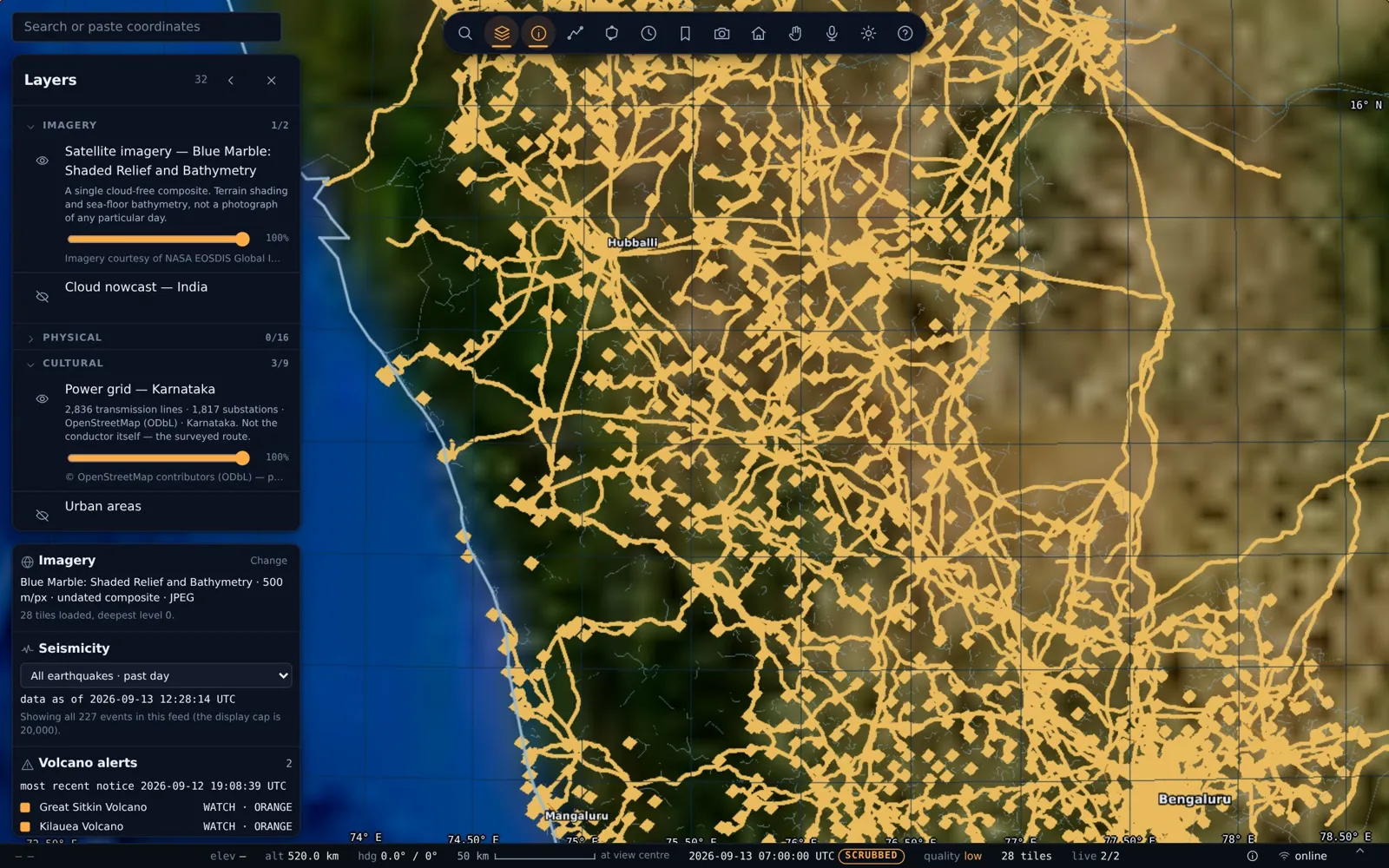
Roads from OpenStreetMap, rivers from HydroSHEDS, glacial lakes from a research inventory, drone zones from a regulator and forest masks from satellite classification arrived in five formats, and all became layers through the same pipeline. GeoJSON, shapefile, GeoPackage, OSM PBF, GeoTIFF and COG, CSV points, or any format GDAL reads.
- Extract
- Clip to your region and filter to what matters, with the threshold recorded. India's 255,319 HydroRIVERS reaches became 16,427 by stream order, and the number is in the manifest.
- Bake
- Rings and points are packed into the binary arrays the app reads, generalised to a tolerance derived from the renderer, and measured for worst-case deviation.
- Declare
- Every layer carries its title, source, licence, feature count and snapshot date. A layer with no attribution refuses to load.
- Switch on
- The layer appears in the panel under its category, with an opacity slider and its provenance note, and can be shown by voice.
Rasters too
Cloud-optimised GeoTIFFs are read by range request on demand, so a 10 m forest mask covering a state drapes over the globe without being downloaded whole.
Time series are layers with dates
Ten annual glacial-lake inventories, 2008 to 2017, ship as ten layers, so a change over a decade is two toggles.
Modelled data is labelled modelled
A predicted distribution grid draws in a different line style from a surveyed one, and its note says so.
Your data stays yours
Private rasters sit behind a read-only, allow-listed proxy on your own host. Nothing is uploaded to a third party.
The instrument
Six operations, each with a method it can defend.
- Measurement
- Geodesic paths on WGS84 by Vincenty's formulas, drawn as true great-circle arcs with per-segment length and bearing. Polygon area by exact spherical excess, verified against l'Huilier's theorem. Self-intersecting polygons are refused, not approximated.
- Inspection and selection
- Exact picking through a spherical point-in-polygon index, and an inspector with computed area, perimeter and centroid under a provenance badge.
- Search
- One gazetteer over every country, state and place, including alternate-language names. Type it, paste coordinates in any notation, or say it.
- Choropleth
- Equal-interval, quantile or Jenks breaks; colour ramps checked for colour-vision deficiency; a legend with real breaks and per-class counts that hatches no-data distinctly and doubles as a filter.
- Time
- Earthquakes carry a temporal window with a histogram, cumulative or instant modes, and a data-as-of line.
- State you can share
- Camera, basemap, visible layers, thematic settings, time window and selection serialise into the URL. A bookmark is a link.
What it declines to do: no elevation readout until a terrain source is on board, because a fabricated height would break the first rule; no interpolation across a gap in the data, ever.
From orbit to one kilometre
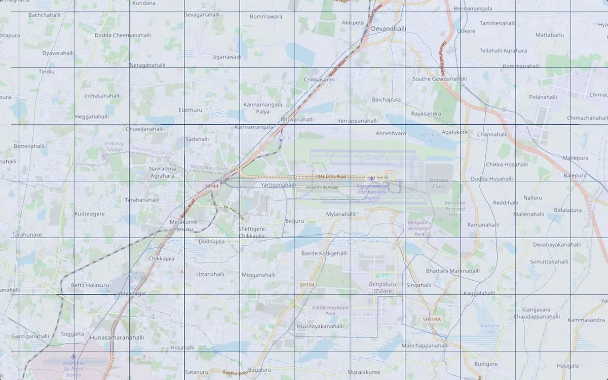
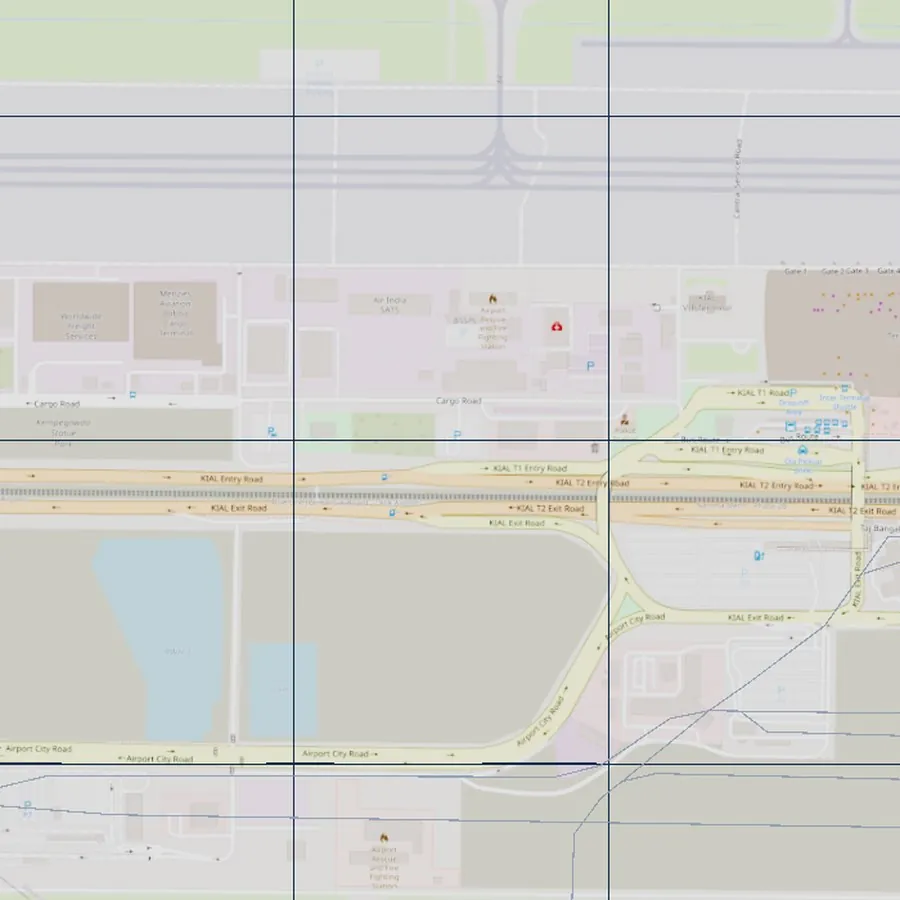
Fly from the whole Earth to a single runway, and the lines stay sharp all the way down.
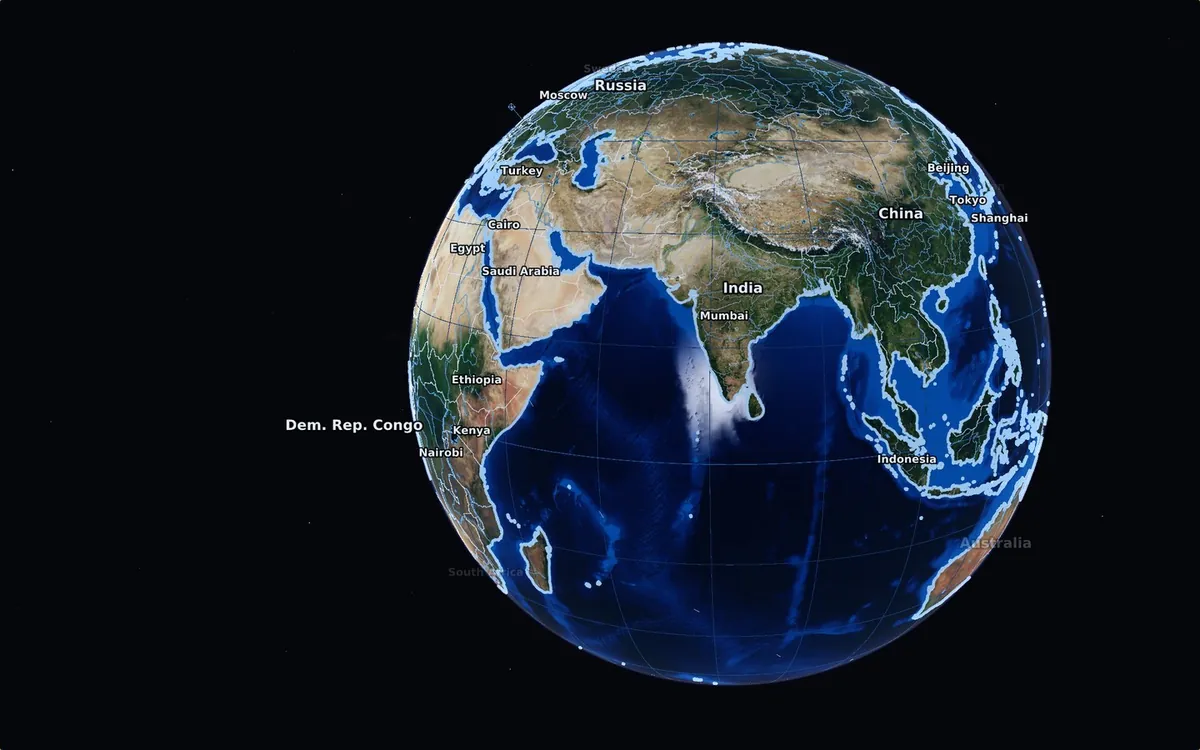
The camera descends to 1,000 m above the ground. Offsets scale with altitude, the near and far planes follow the horizon, and vectors are baked in double precision, so a road at one kilometre sits where the survey put it. Below the natural scale of open 10 m imagery, TerraLens keeps the picture crisp with vectors and an OpenStreetMap street basemap warped onto the globe live, and your own high-resolution rasters can take over where you have them.
- 0.767 m/px
- ground resolution at 1,000 m on a 1080 px display
- 0.0144 px
- worst positional drift down the whole descent, against a 0.5 px threshold
- 14
- imagery tile levels, to 0.48 m per pixel where a source supplies it
measured on the live build, Sep 2026
India, ready to switch on
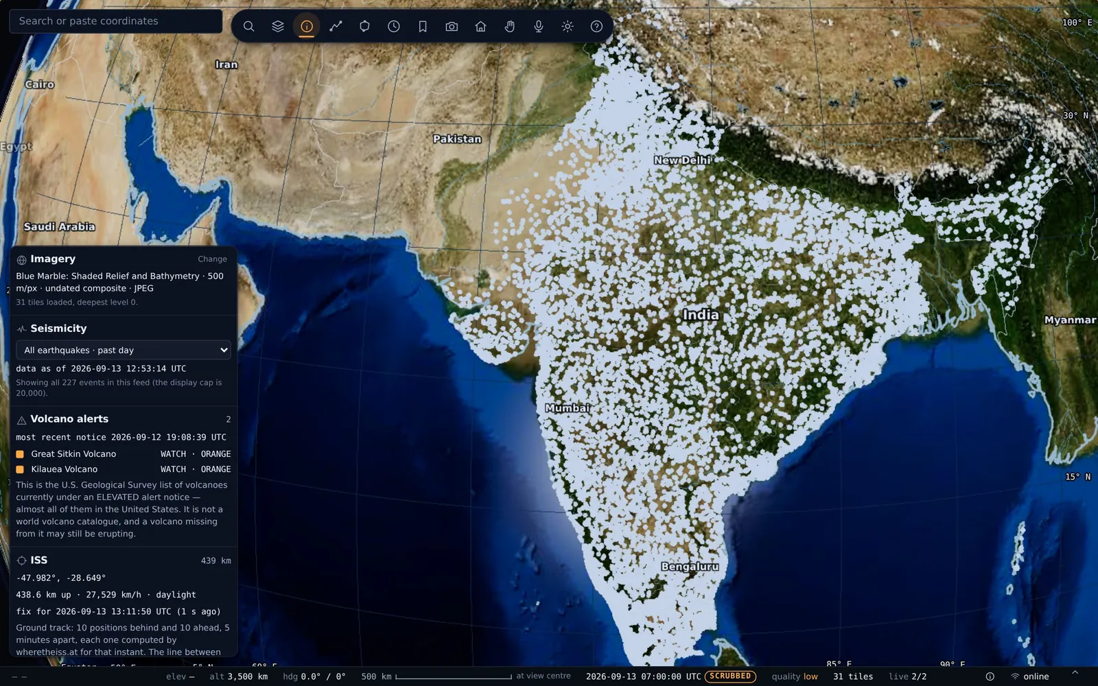
Sixteen India datasets already baked, credited and one click away.
| Layer | Features | Source and licence |
|---|---|---|
| Rivers (HydroRIVERS) | 16,427 | HydroRIVERS v1.0, Lehner and Grill (2013) |
| Glacial lakes, ten annual inventories 2008 to 2017 | 12,593 to 15,348 | Hi-MAG, Chen et al. (2021) |
| Major roads | 401,943 | OpenStreetMap contributors, ODbL |
| Hospitals | 50,062 | OpenStreetMap contributors, ODbL |
| Aerodromes | 43 | OpenStreetMap contributors, ODbL |
| Drone zones, red and yellow | 383 and 638 | Restricted airspace buffers, Drone Rules 2021 |
| Power grid, Karnataka | 2,836 routes, 1,817 substations | OpenStreetMap power tags, clipped to the state boundary |
| Predicted distribution, Karnataka | 30,390 | gridfinder, CC BY 4.0, drawn dashed and labelled modelled |
| Forest, tree and perennial masks, Karnataka, 10 m | 3 × 247 tiles | Cloud-optimised GeoTIFFs, read on demand |
| Reefs, ice shelves, seas, glaciers, urban areas, airports, ports, detailed rivers | 8 layers | Natural Earth, public domain |
Counts as shipped, 13 Sep 2026. Each layer's generalisation tolerance, measured worst-case deviation and snapshot date ship in its manifest entry.
Imagery, sun and live feeds
Ten NASA products, a real sun, and feeds that tell you their age.
- NASA imagery
- Blue Marble; Earth at Night; MODIS and VIIRS true colour; land surface temperature; snow cover; sea surface temperature and its anomaly; IMERG precipitation; ASTER shaded relief. Each legend prints real units, and a failed tile shows a hatch rather than a stretched neighbour.
- The sun is computed, not painted
- A true subsolar point drives a real directional light, atmospheric scattering is ray-marched, night lights come up on the dark side, and the ocean carries sun glint.
- Earthquakes
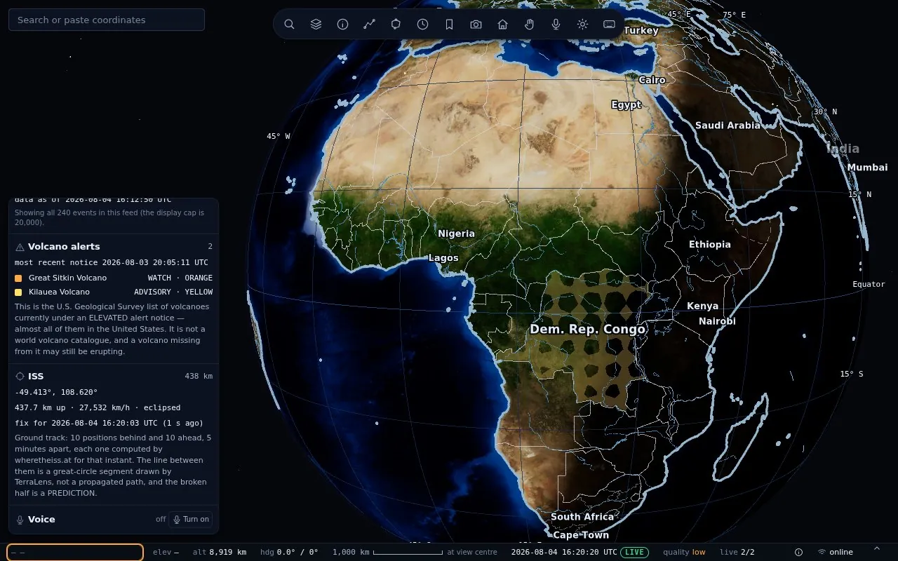
- USGS feeds by magnitude and period, marker size proportional to the square root of energy, colour by depth, each event placed at its true depth.
- Volcano alerts and the ISS
- The USGS elevated-alert list, labelled for exactly what it covers; ten ISS positions behind and ten ahead, with the half in front labelled a prediction.
Sources, licences and access
Everything on screen has a line in the attribution panel, and the panel is burned into every export.
- Data
- Natural Earth; NASA GIBS imagery under NASA's open data terms; USGS feeds; OpenStreetMap contributors (ODbL); HydroSHEDS; Hi-MAG; gridfinder (CC BY 4.0).
- Code
- Three.js, MediaPipe Tasks Vision, geotiff.js, vosk-browser and Kokoro, all vendored and committed with hashes recorded.
- Deployment
- A directory of files behind any static server, on your infrastructure or ours, with a read-only, allow-listed proxy for private rasters.
- Verification
- Thirty-five test suites cover geodesy, packing, picking, search, choropleth, gestures, voice grammar, deep zoom, and a browser run that switches on every layer against the live build.
- On the roadmap
- Sentinel-2 10 m imagery as an open basemap, OpenStreetMap vector tiles from your own extract, and a corridor-risk view over the power grid.
What it does
- 16 India datasets ready to switch on, from rivers and glacial lakes to hospitals and drone zones as shipped, 13 Sep 2026
- 11 basemaps, including 10 NASA imagery products and an OpenStreetMap street map as shipped, 13 Sep 2026
- Zoom from orbit to 1 km above the ground with lines kept sharp measured on the live build
- Geodesic measurement, choropleths, time windows and shareable state in the URL
- Private rasters stay behind a read-only proxy on your own host
An unknown value prints a dash, never a zero. Nothing geographic is fabricated or interpolated to fill a gap.
Who it is for
- Planning and infrastructure departments
- Utilities mapping networks and assets
- Command centres and briefing rooms
- Research and GIS teams
How it starts
Send your files
In the format you already have.
Bake
Your datasets onboarded as layers, typically within a day.
Fly
On a laptop, a phone on a stand or a wall display.
See it on your own data
Write to us and we will set up a walkthrough of TerraLens on live data.
Email info@aionpl.com